
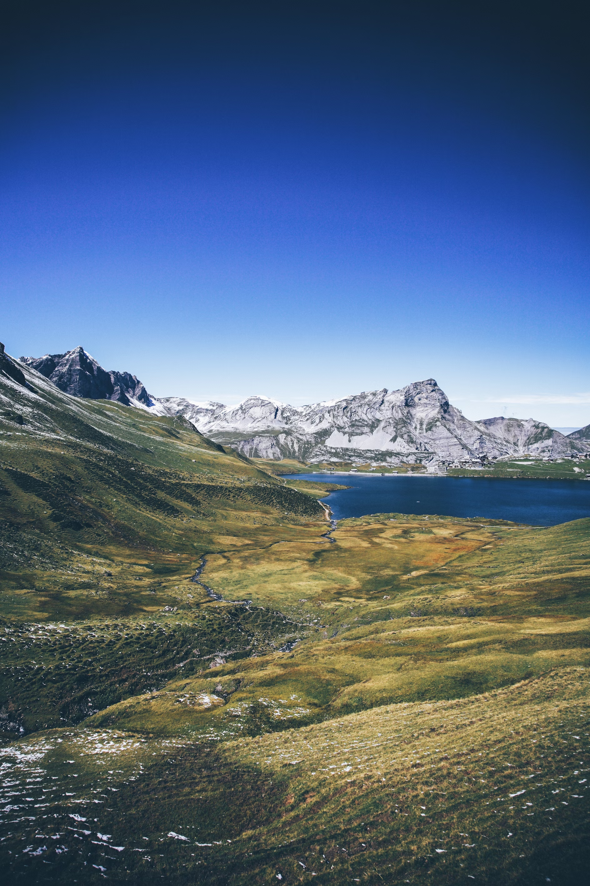
Melchsee Frutt
- 27/12/2019
Lauterbrunnen lies at the bottom of a U-shaped valley that extends south and then south-westwards from the village to meet the 8 kilometers Lauterbrunnen Wall. The Lauterbrunnen Valley (Lauterbrunnental) is one of the deepest in the Alpine chain when compared with the height of the mountains that rise directly on either side. It is a true cleft, rarely more than one kilometre in width, between limestones precipices, sometimes quite perpendicular, everywhere of extreme steepness. It is to this form of the valley that it owes the numerous waterfalls from which it derives its name. The streams descending from the adjoining mountains, on reaching the verge of the rocky walls of the valley, form cascades so high that they are almost lost in spray before they reach the level of the valley. The most famous of these are the Staubbach Fall within less than one kilometres of the village of Lauterbrunnen. The height of the cascade is between 240 and 270 m, one of the highest in Europe formed of a single unbroken fall.

The river Weisse Lütschine flows through Lauterbrunnen and overflows its banks about once a year. The source of the river comes from melting snow high in the mountains, thus making it a very pure and clean source of water. It is common practice in the camp sites to chill drinks in the water. Trummelbach Falls is 3 km (1.9 mi) from Lauterbrunnen, connected by bus from the station.

The municipality of Lauterbrunnen extends a considerable distance beyond the village and valley, with an area of 164.51 km2. It reaches as far as the peaks of the Eiger, Mönch and Jungfrau to the east, the Gletscherhorn, Mittaghorn, Grosshorn, Breithorn and Tschingelhorn to the south, and the Gspaltenhorn and Schilthorn to the west. The Kleine Scheidegg Pass crosses over to Grindelwald to the east, whilst the Sefinenfurgge Pass crosses to Griesalp and Reichenbach im Kandertal to the west; both passes carry hiking trails that form part of the Alpine Pass Route, a long-distance hiking trail across Switzerland between Sargans and Montreux. Besides the village of Lauterbrunnen, the municipality also includes the villages of Wengen, Mürren, Gimmelwald, Stechelberg, and Isenfluh.

Vallon-Pont-d’Arc is a capital of prehistoric and cultural tourism. This small village, peaceful in wintertime, sees its population expand ten-fold in summer. Its tourist importance largely comes from the fact that it is the departure point for the river descent of the Gorges de l’Ardèche (from Pont d’Arc to Saint-Martin-d’Ardeche).

Wales is a country that is part of the United Kingdom and the island of Great Britain. It is bordered by England to the east, the Irish Sea to the north and west, and the Bristol Channel to the south. It had a population in 2011 of 3,063,456 and has a total area of 20,779 km2 (8,023 sq mi). Wales has over 1,680 miles (2,700 km) of coastline and is largely mountainous, with its higher peaks in the north and central areas, including Snowdon, its highest summit. The country lies within the north temperate zone and has a changeable, maritime climate.


